The Chickasaw Village Sources
As described by many Europeans and Americans, the Chickasaw lived in villages throughout the eighteenth century. However, Dr. Rush Nutt (JMH IX 1) noted that the Nation began moving out of their villages in 1797 and they were largely abandoned by 1805 as the Nation took up agriculture and settled in family farms across their lands. This paper focuses on the village locations during the eighteenth century.
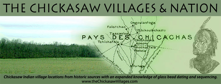
Table 1 indicates the names of the Chickasaw villages described by various primary eighteenth century sources. Note this table is an extension of Swanton (Swanton BAE 44 212) who had five lists of Chickasaw village names available (Iberville, Adair, De Batz, French Memoir and Romans) and Cook (Cook Table 1). The names of the primary sources are the column headings and the village names for that source appear below. Note that both the number and names of villages changed with time. Many of the village name changes can be attributed to spellings and the bias of the ear that heard them.
Table 1 attempts to phonetically associate the names of the villages horizontally. Each horizontal line represents the same village, irrespective of its location. The number of villages changing with time is more problematical and will be dealt with herein and in the following paper, "Chickasaw Villages Defined by Bead Dating". Table 1 serves as a source of reference throughout this paper.
As stated above the "source" and "year" on Table 1 are noted as column headings for each reference. Note that some of the sources provided village descriptions without making personal contact with the Chickasaw; some of the sources did not make first person contact with the Chickasaw at their villages, rather reported the village names and/or village situations from secondary sources.
The sources from Table 1 are introduced below to offer a biographical perspective and indicate their knowledge of the Chickasaw villages. We will take a moment to introduce the Table 1 sources. These sources provide the key to the village locations. Note that when the 1980 paper of Cook did not include several of these sources, namely Nairne and McGee. In addition two Mississippi Provincial Archives, French Dominion, have been published, Volumes IV and V. Taken as a group, the new material adds significantly to the Chickasaw village locations. A summary of the Table 1 sources follows. Note that the source's relationship to the Chickasaw when known is stated
Pierre Le Moyne, Sieur D'Iberville (MPA II 10) provides eighteen Chickasaw village names for the year 1702 (Swanton BAE 44 212). Note that Iberville although in charge of French Louisiana did not physically visit the Chickasaw villages; rather he would have reported the names provided him by a subordinate, probably a Canadian voyageur, perhaps Henri Tonty. D'Iberville born French Canadian in 1661 served as head of Louisiana from 1699-1702 and made three voyages to the fledgling colony.
Thomas Nairne was a Carolina Indian agent who recorded a visit to a Chickasaw village in April 1708. While Nairne's journal does not provide detail village location descriptions, Nairne's records give valuable insight to the Chickasaw villages. Nairne is not included on Table 1 as he named one Chickasaw village.
James Adair (Adair 1930 Forward) is the next source on Table 1. Note that James Adair was a trader with the Cherokee, Catawbas and Chickasaw and lived with the Chickasaw from 1744 to 1750 and again from 1759 to 1766. Adair then would not have lived among the Chickasaw in 1720, the date of his village reference, but carefully selected that date to report their village locations and names. Adair returned to England where he completed his definitive book, The History of the American Indians, published in 1775 (Adair 1775). He moved back to the Carolinas, where he died a few years later.
Edmund Atkin (TAIF Preface) was an English born Charleston merchant with a long experience in Indian trade. He became a member of South Carolina Governor Council. Because of his trade experience he wrote two treatises on the frontier Indians. The better known is The Edmond Atkin Report and Plan of 1755 which proposed a change of British Indian Policy. His plan was well received and timely, resulting in his appointment as the Southern Imperial Indian Superintendent where he served until his death in 1761. Atkin never reached the Chickasaw villages but he had profound information about them from their traders. As Indian Superintendent he met several Chickasaw and Choctaw in Charleston.
The Baron de Cresnay (MPA IV 76) was a lieutenant colonel in French Louisiana, active in campaigns against the Natchez after the annihilation of Fort Rosalie in 1729. The location of the surviving Natchez among the Chickasaw and their destruction was vital to the French reputation during the 1730's. The 1733 map of de Cresnay encompasses the territory between the Chattahoochee and the Mississippi Rivers. Swanton (Swanton BAE 73 Plate 5) used the map to aid his location of Creek villages. The Chickasaw mapping include streams, a portage, roads and village names; however, the scale is small.
In 1737 Lieutenant Alexandre de Batz drew a map (MPA IV 155) of the Chickasaw villages at Fort St. Louis, which was provided him by Captain of Pacana, an Alabama Indian, on a white deerskin hide. The Captain of Pacana had just visited the Chickasaw villages and provided the relative positions of the villages and their names, and local streams. Although there is no record of de Batz visiting the Chickasaw villages prior to that time, his map is specific to the Chickasaw villages. De Batz, an engineer, architect, draftsman and artist, produced maps and drawings of French Louisiana from 1730 to 1760.
The French Memoir villages of 1755 were published by Swanton (Swanton BAE 44 212). Although there is not a map supporting this document, the village names are relevant. The French and/or their Choctaw allies conducted annual campaigns against the Chickasaw and their crops beginning 1737. South Carolina and Georgia traders living among the Chickasaw recorded first hand accounts of some of these campaigns in their journals (SCIAD 1750-1754 and 1754-1765).
Although British cartographer Joseph Purcell never visited the Chickasaw, he produced a map of the Chickasaw villages in 1770 (Swanton BAE 73 Plate 7). Like the De Cresnay map, the Purcell map covers a much broader view of British West Florida, than strictly the Chickasaws. Swanton attributed the map's date to no later than 1770.
In 1771 Bernard Romans (Romans 1999) visited the Chickasaw villages for the service of the British and provided a first hand description of the villages and their names. Romans was born in Holland and educated as an engineer who later gained botanical skills. During the American Revolution, Romans switched allegiance to the American side. He was captured by the British and switched his allegiance again.
Major John Doughty (ETHS 17) in 1790 visited the Chickasaw villages on a mission from the Secretary of War of the United States. He provided a first hand description of the villages.
Malcolm McGee resided with the Chickasaw beginning as a young boy about 1768 (Draper 2). He was noted as the tribal interpreter on several of the Chickasaw land cessions to the United States. McGee could not write so he did not keep a journal but as an old man was interviewed by Lyman Draper in Tupelo before 1841. McGee provided the village names and directions to them. We may assume that most of his descriptions apply to the late 1770/80/90s.
In 1796 Victor Collot (Swanton BAE 73 Plate 10), a French cartographer, produced a map of the Chickasaw villages. Collot did not visit the Chickasaw villages; however, the map provides impressive location accuracy for streams, topography and village information. Swanton attributed the date of this map to 1796-1800.
Dr. Rush Nutt was a planter near Natchez, Mississippi and an amateur scientist. He made a trip up the Natchez Trace in 1805 and visited the Chickasaw. Although the villages were largely abandoned by the time of his visit, he provided an accurate census, names of villages and other information about the earlier villages.
A resource, rather than a source, frequently used within are the Mississippi Provincial Archives, French Dominion (MPA) publications, five volumes in total. These consist of translated letters and correspondences between French colonial Louisiana and France, usually the Ministry of the Marine.
In large part, these sources when used will be quoted. The intention is to let the reader experience the quote as it was recorded. The reader will notice many misspellings and grammatical errors of these sources' quotes, all part of their life and experiences among the Chickasaw.
The geographical environment of these sources and their sponsoring governments in the eighteenth century should be given attention. In short the political landscape changed throughout the century. From the last of the seventeenth century into the 1760s the Chickasaw were allied with the English in South Carolina, see Adair's Map. The map demonstrates the location of the Chickasaw, "Chikkasah Towns" and "Charleston" where the seat of South Carolina's government resided and where the English traders among the Chickasaw took slaves and skins. Note too that this paper will address an exodus group of Chickasaw that moved to "Augusta, Ft. Moore, or New Windsor". The French seat of power in Louisiana was in "Mobile or Ft. Conde" and "New Orleans". The Chickasaw claimed a portion of the Mississippi River. Throughout the first six decades of the eighteenth century the Chickasaw reminded the French of that claim.
Regarding the Chickasaw there was no recorded language. Not only will the reader experience a myriad of village names, he will see the village names as recorded by the sources, as that source heard the name.