Discussions
The figures presented herein will be discussed along with the Paper 1 interpretive figures. The figures will be presented in temporal order beginning with Figure 2. It is not the intention of the author to reproduce the history of the villages presented in Paper 1 (The Decade and the Villages). Where appropriate, references from Paper 1 are repeated.
Where warranted, individual features will be revisited to expose the latest dated bead in a feature. That is, a bead dating post 1693 occurred in a feature with a post 1759 bead.
Post 1675, Post 1690 and Post 1710
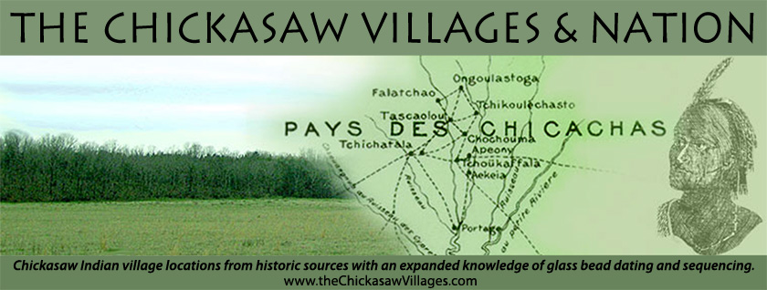
Figures 2, 3 and 4 provide views of the Chickasaw occupation post 1675, post 1693 and post 1710. Given time for the beads to be interred, Figures 2, 3 and 4 fairly represent the earliest of the interpretive maps, that of James Adair, dated 1720 (Paper 1 Figure 1). Note that Figure 3 illustrates all zones of SP occupied save SP5, which the author noted as yielding features with IIA1/IVA1. SP of Figures 2 and 3 correspond to Adair's Chookka Pharaah.
In like manner, Figures 2, 3 and 4 indicate that all of CO, save CO9 is occupied. Again, this corresponds well with Adair's description of the nine miles of settlements, and his description fits the features and zones. If Figures 2 and 3 were combined, the density of settlement would occur towards the center of CO. On the 1720 Adair interpretive map (Paper 1 Figure 1) three village locations were assigned: Phalacheho, Shatara, and Hykehah, however, Chookheerso and Tuskawillao were not located. Phalacheho and Shatara were the largest villages; Shatara exhibited other names like Copper Town that survived the eighteenth century (Paper 1 Table 1). The locations of Phalacheho and Shatara were made in the 1980 paper "The Chickasaw Villages" (Cook, Palmer, Riley) and the rationale will not be repeated. On Figures 2 and 3, CO3 represents 1720 Phalacheho while CO4 represents Shatara. If we assign locations for 1720 Chookheerso and Tuskawillao due to feature density on Figures 2 and 3, then CO6 and CO7 represent these villages. After the loss of Yaneka in 1722/3 these villages would have no protection to the south.
Yaneka or CH as defined on Figures 2, 3 and 4, illustrates most of the village described by Adair as "about a mile wide and six miles long". Features containing post 1693 glass beads have been found in all five CH zones. Clearly Yaneka was occupied post 1675, post 1693 and post 1710.
The OT zone locations noted on Figures 3 and 4 at OT4 and OT5 represents three features. All of these features contained later dated beads. In one feature, a single specimen of IIA1/IVA1 was recovered with 300 IA/IIIA Opaque, indicating that the IIA1/IVA1 served as an heirloom (defined in Figure 2 as a much earlier dated single bead occurring with later dated beads within a feature) for a post 1759 burial. The other two features include latest dated bead type WIA VL/XL, so these features represent post 1730 dating. Therefore, OT was not occupied per Figures 3 and 4, post 1693 and 1710, respectively. However, as stated earlier the feature noted on Figure 2 at OT4 postdating 1675 included only IVA2 bead varieties, indicating that OT was still occupied about 1675.
Post 1730
Figure 5, dating post 1730, will be compared to the De Cresnay 1733, De Batz 1737 interpretive maps, Paper 1 Figures 7, 9, respectively, and Adair's 1720 interpretive map (Paper 1 Figure 1). Recall from Paper 1 (The Decades and the Villages 1730-1740) that the French engaged the Chickasaw in two 1736 campaigns. The village locations were changing rapidly and even Bienville confessed confusion to the various reports.
Figure 5 indicates that all of the SP occupation is situated in SP1, also shown on the interpretive De Cresnay map (Paper 1 Figure 7). In fact, this is how Bienville found the small prairie when he attacked it in 1736. The post 1730 villages that occupied SP1, which were mapped by De Cresnay and De Batz, see interpretive maps, had by the end of October 1737 moved to Old Town (Old Town interpretive map Paper 1 Figure 10). French Lieutenant Delery in October 1737 described the four just abandoned Chickasaw forts at SP1. The three villages that occupied SP1 for the most part moved into Old Town; their positions within Old Town unknown but probably at the south end of OT3 and OT4, just north of Kings Creek. This area of lower ground would represent the least desirable position next to that occupied by the Natchez-OT5 (in Paper 1 Old Town was noted to be vulnerable from the east, as no swamps existed).
On Figure 5 CO occupation is confined to CO3, 4 and 5, contiguous areas. CO 3 represents a post 1730 occupation of Adair's Phalacheho. But note on the De Cresnay map that by 1733 Falatchao (Adair's Phalacheho, see Paper 1 Table 1 for phonetic associations of all villages) had moved south of Kings Creek a move verified by De Batz's 1737 interpretive map. Recall from Paper 1 (the Decades and the Villages 1730-1740) that the remnant Natchez moved into Falatchao in 1731, probably overwhelming its defenses and resources, precipitating a move to Old Town, south of Kings Creek. Recall that the trail that was to become the Natchez Trace ran through this village on Coonewah Creek (Paper 1 Figure 3).
On Figure 5 CO4 and CO5 represent the two forts of Chatelaw (Adair's Shatara, De Cresnay's Tchichatala and De Batz' Tchitchatala), attacked by Diron D'Artaguette in late 1734 with great Chickasaw casualties. Coonewah Creek separates the forts of CO4 and CO5. The features demonstrated at CO4 and CO5 could represent victims of the 1734 attack. Note that this village(s) is shown at Old Town on the southeast side on the De Batz map of 1737 (Paper 1 Figure 9) or OT8 on Figure 5. Note Chambers and Jennings dug OT8 in the late 1930s and early 1940s. Many WIC and WIA VL/XL features were recorded but unused herein. The Chicksaw Nation repatriated this material in keeping with tribal policy.
Neither WIC nor WIA VL/XL were found in features at CH, Adair's 1720 Yaneka. Paper 1 concluded that Yaneka constituted the exodus village that moved as a result of the 1722/3 Choctaw wars to near Fort Moore in South Carolina.
Figure 5 indicates a reoccupation of Old Town. OT3, OT4, and OT5 each show occupation north of Kings Creek as does OT7 and OT8 south of Kings Creek. Note the author has seen WIA VL/XL beads from a single feature found at OT6 from a collector not interviewed. The occupation at OT6, OT7 and OT8 mirrors the villages shown on the interpretive De Batz map (Paper 1 Figure 9) can be located-Etoukouma (OT6), Falatchao (OT7) and Tchitchatala (OT8). Note that the ridge south of Kings Creek was not defensible to the south, towards the Choctaw.
As stated in Paper 1, French artifacts- coins and Jesuit rings and medals have been found exclusively at Falatchao CO3 and Tchitchatala CO4. These two villages' maintained relations with the French longer and held out in their positions on Coonewah longer than their neighboring 1720 villages. These extended French relations may have gained them their initial, indefensible settings at Old Town, south of Kings Creek. For the villages that first moved into Old Town following the 1722/3 Choctaw attacks, would have occupied the ridge above Town Creek in OT2, OT3, OT4 and OT5. Although not supported by features on Figure 5, the description of the Ogoula-tchetoka location would have it located at OT2 at Belden where a collector found an intact French grenade. After the Illinois French attack of 1736 on this village, it moved to closer affiliation with the other Old Town villages in OT3. OT3, OT4 and OT5 represent the locations of all the villages in the Nation from at least 1740 until 1772 (Old Town interpretive map Paper 1 Figure 10).
Post 1759
Figure 6 indicates the feature plots containing WID and IA/IIIA Opaque, which on Table 1 postdate 1753 and 1759, respectively. The later dated IA/IIIA Opaque dated post 1759 and Figure 6 postdates Figure 5 by 29 years. Note these two bead types occurred in 64 features. As Paper 1 noted (the Decades and the Villages 1750-1760, 1760-1770, and 1770-1780) this period of time found the Chickasaw resolve at its best, surviving day-to-day despite French bounties on their scalps and their horses scalps until 1763. McGee indicated that the Chickasaw began leaving the protection of the then resource depleted Old Town in 1772.
Figure 6 reveals features occurring in mostly eastern OT, north of Kings Creek, the north two zones of SP and five zones of CO. OT south of Kings Creek is not represented. The density of features is at OT4, CO3 and SP2. Note that CH is not represented post 1759. Paper 1 Figure 13 provides an interpretive map showing this continued occupation at OT, also called Big Town; occupation at SP is focused at SP2, also called Long Town by the village chroniclers (Paper1 Table1) and a major occupation at CO, called Copper Town. Note that the Copper Town descriptions provided by McGee, Doughty and Nutt and mapped by Collot (Paper 1 Figure 12) do not coincide with CO3. Copper Town as mapped and described is in all probability located in CO6 and represented by one feature on Figure 6.
Post 1772
Figure 7 illustrates the location of the features that held WIA M. Note this bead occurred with 26 features. WIA M is post dated 1772 or thirteen years later than WID and IA/IIIA Opaque. Recall the devastating measles outbreak of 1784 mentioned earlier. The distribution of features on Figure 7 patterns that of Figure 6 with the densest zones identical. In Figure 7 CH remains uninhabited, as does OT south of Kings Creek.
The Collot map of 1790 (Paper 1 Figure 12) allows us to identify CO3 as Salle Burnaby Village. Copper Town remains hidden per the beads, the late village remains to be discovered.
Post 1795
The five features postdating 1795 are shown on Figure 8. Recall from Paper 1 (The Decades and the Villages 1790-1800) that by 1805 the villages were abandoned and separated into the districts described by Dr. Rush Nutt. Note that SP or Long Town is abandoned; this may witness the American faction that lived there following Washington's advice to take up husbandry.
Likewise, Coonewah CO shows one feature.
Chiwapa CH indicates two features, perhaps Dr. Nutt's Pontatock. These feature representations in CH are the first since Figure 4 postdating 1710.