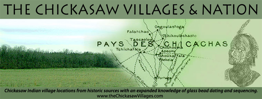
Village Zone Areas - Review of the Figures
For each of the village zone figures presented, a bead or combination of temporally associated beads is labeled as post dating the latest dated bead of the combination. Note the post date represents the earliest start of trade date for the latest dated combined bead, which does not represent when the bead was interred in a feature. To estimate the date of interment, life expectancy must be added to the earliest start of trade date of the beads in the figure. Given the Chickasaw slave raids beginning in the early 1690s, the Choctaw wars beginning 1722/3, the Chickasaw wars with the French in the mid 1730s, the French Chickasaw scalp policy and the diminished environmental conditions relative to the second occupation of Old Town, it is probable that the average Chickasaw life expectancy changed, probably decreased from 1690 to 1760. Perhaps the beads were in an individual's possession as long as thirty years in 1690 and perhaps twenty years in 1760.
Almost two-thirds of the 188 features contained more than one glass bead type/variety. Each major (and minor where used) bead type/variety irrespective of the latest dated glass bead within the feature will be shown, i.e. assume IVA2 and IIA1/IVA1 were found in a single feature. In this example, Figure 2 will demonstrate the feature's IVA2 while Figure 3 will show the IIA1/IVA1. When needed, explanations regarding the individual features will be provided. In addition, single bead features and single bead occurrences within features will be mapped.
The features represent burials, and the Chickasaw as reported by James Adair and others noted burials within the house walls. Herein, features represent occupation (village locations) and the author may juxtapose the terms.
Figure 1 expresses shaded areas, which represent village areas illustrating the union of the 1720 villages described by Adair (Paper 1 Figure 1) and the Old Town interpretive map (Paper 1 Figure 14). These village areas are conjoined on Figure 1 to include the village areas potentially occupied during the mid and late 17th century with those of the 18th century.
Note too on Figure 1 that relatively short, heavy lines bisect the shaded village areas, most positioned at right angles to the village areas. These lines establish the boundaries between neighboring the village zones; these lines correspond to contemporary streams, which divide the ridges. There are 28 zones distributed over the village areas of Figure 1. To the south, there are five zones on Chiwapa Creek with the designation 'CH'. Moving north, along Coonewah Creek there are 10 zones beginning with the alphabetic designation 'CO' (note that zone CO10 lies southwest of Coonewah ridge and CO5 is situated just east of Coonewah Creek). East of CO are situated the Town Creek zones which are noted by 'SP' (for Bienville's "small prairie") and OT "Old Town" alphabetic prefixes. At the southern end are the five 'SP' zones. North of the SP zones are eight OT zones. Zones OT1-5 are located south of Town Creek and north of Kings Creek while Zones OT6-8 are arrayed south of Kings Creek.
On Figure 1 note that whole numbers illustrate the distribution of the features on the village zones, while zones void of features representing the labeled glass beads are indicated with a 0. Note that Chiwapa creek area CH demonstrates 15 features; Coonewah Creek designated CO holds 71 features; the small prairie on Town Creek SP shows 52 features; and, Old Town includes 50 features, for 188 total features. It is assumed that the features (burials) were made within the houses in which the Chickasaw lived as described by Adair and others.
Only OT2, OT6, SP5, CO9, CH3 and CH5 do not demonstrate a feature occurrence. Although as stated earlier, glass bead types/varieties included in these papers have been found within all of the village zones.
The earliest bead types/varieties from Table 1, IB/IIIB XL, IA/IIIA VL1, IIIA1, IVB (IVA2) and IA/IIIA XL, represent minor beads (less than 18 features, per Paper 2). These minor beads were combined with major bead variety IVA2, as the minor beads could not be accurately dated by the methods used in Paper 2; incidentally, these minor beads' occurred with IVA2 in 81% of the IVA2 features. That said the minor beads and IVA2 are labeled on Figure 2 as dating post 1675. Note on Figures 2 through 8, that the bead's "postdate" represents the earliest trade date for that bead. However, these figures demonstrate the beads in features. Therefore to the beads' "postdate" must added the average trade of the beads and the added remaining average life expectancy of the individual. One can assume that this time lapse on average may have been twenty to thirty years. However, conditions of war or disease could have reduced that lapse in time to days.
The 27 features containing these beads are geographically located on Figure 2. The distribution includes three areas of SP, five of CO and one of CH and note that only one feature is mapped at OT-OT4 (Paper 1 Figure 14). This feature contained IVA2 glass beads exclusively. This figure illustrates that before or about 1675, Old Town, as described by Malcolm McGee and James Adair (Paper 1 The Decades and the Villages 1690), was all but abandoned. Further Figure 2 indicates that Old Town's Chickasaw residents/villages had left its sanctuary and dispersed to CH, SP and CO. In all likelihood, the Old Town abandonment was the result of depleted resources. Recall for Figures 2 through 8 a time lapse exist between the "start of trade" of the subject bead to the date of interment.
Figure 3 indicates the distribution of features containing glass bead types/varieties IIA7/IVA7, IIA1/IVA1, IIA/IVA Other and IIB/IVB, major beads i.e. each of these bead types/varieties occurred in eighteen or more features. In fact, 78 features are included in the distribution. The latest early date for these bead types/varieties is IIB/IVB at 1693; therefore, Figure 3 postdates 1693. Figure 3 represents features eighteen years later than Figure 2. All three of the OT features included later dated beads. The prevalent areas that yielded these beads are found outside of Old Town. Note that four zones of SP are represented, as are nine zones of CO and two of CH. The author is aware IIA1/IVA1 occurring at SP5 and CO9. The greatest density of features is in zones SP3, CH1, CO3, CO7 and CO4.
Figure 4 demonstrates the distribution of major bead type WIIA, which was found in eighteen features. The distribution at Old Town is two features in two zones while SP is distributed in four zones, CO occurs in four zones, and CH in two zones. Both of the Old Towne features included later dated major bead WIA VL/XL. The extent of the post 1710 Chickasaw villages appears unchanged at SP, reduced at CO and similar at CH, compared to post 1693, Figure 3, but there are fewer features available in Figure 4. In fact, a union of Figures 3 and 4 yields a fair parallel to the interpretive village map described by Adair for the year 1720 (Paper1 Figure 1).
Figure 5 demonstrates the feature distribution that contained two major beads WIC and WIA VL/XL. From Table 1 these beads were earliest dated in Paper 2 at 1725 and 1730, respectively. Figure 5, representing 39 feature locations postdates 1730. Given the climate of war that existed post 1722 between the Chickasaw and the French (and their Indian allies), life expectancy was greatly diminished for the following decades. This is especially true in the mid to late 1730s when French sponsored raids and pitched battles caused considerable Chickasaw casualties, (see Paper 1 The Decades and the Villages 1730-1740).
Figure 5 represents beads twenty years more recent than Figure 4. However, note the geographic reduction at SP and CO when comparing Figures 3 and 4. SP occupation nucleates to SP1 per Figure 5 and only three contiguous zones of occupation are demonstrated at CO. Figure 5 indicates a reoccupation of OT both north and south of King's Creek. Of significance, Figure 5 indicates that there is no occupation at CH. Two 1730s French maps: De Cresnay (Paper 1 Figure 6) and De Batz (Paper 1 Figure 8) and their respective interpretation maps (Paper 1 Figures 7 and 9), are helpful to explain what the post 1730 beads' feature distribution indicates. Figure 5 indicates that Phalacheho (various spellings) and Tchichatala (various spellings) were the only villages on CO. What the Figure 5 village zones do not express is how dense the distribution of the CO features were . . . CO3 and CO5 represent areas of less than two acres each while CO4 represents less than 10 acres. More discussion will follow in the conclusions section.
The major bead types, WID and IA/IIIA Opaque, date per Table 1 to 1753 and 1759, respectively, and represent 64 features. Note that Figure 6 postdates 1759, thus 29 years separates Figures 5 and 6. The distribution of the features containing these beads, Figure 6, includes Old Town, north of Kings Creek; the two zones occupying the north end of SP, the middle zones of CO, including CO10 and CO5. CH has no representation of these beads/features. The French depredations against the Chickasaw ended in 1763. Afterwards, the Chickasaw life span should have increased as French sponsored wars and scalp bounties ended. The densest feature zones are OT4, CO3 and SP2.
The major bead type WIA M was associated with 26 features; its feature distribution is represented on Figure 7. Note the earliest date for WIA M is 1772 or thirteen years later than Figure 6. Chickasaw interpreter Malcolm McGee witnessed the deaths inflicted in the spring of 1784 when the Chickasaw suffered a measles outbreak. McGee noted that Long Town's population was reduced by nearly half. The point being that the Chickasaw life expectancy during the distribution of this bead may have been reduced by the epidemic. The zones of occurrence of the features containing WIA M parallels Figure 6 - OT4, SP2 and CO3.
Two minor beads, IF/IIIF and WIB Wrap, represent the latest beads dating the Chickasaw villages before their abandonment by 1805, (see Paper 1 The Decades and the Villages 1790-1800). Note on Figure 8 that only five features are represented, which should be expected with the villages abandoned 7-10 years after the start of trade of these beads. Of these features, two are found at CH1, one each at OT 3 and OT4 and one at CO2. Neither of these beads are found at SP. Of note, a resettlement of CH is finally detected. In addition, the zones occupied are at OT3, OT4 and CO2.