Glass Bead Dating Conclusions
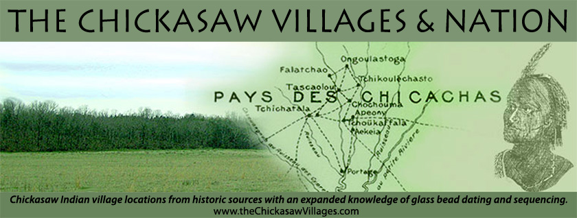
A compilation of the conclusions reached in this paper and Paper 1 follows. The author suggests that the reader refer to Paper 1 Table 1 for associated village names/spellings. As Adair's 1720 villages' description offers the first/best village description, it will form the cornerstone of the conclusions.
Old Town Pre 1675
The pre 1675 Old Town included OT1, OT2, OT3, OT4, OT5, OT6, OT7, OT8 and western side of old field south to SP1. The densest occupation areas are OT1, OT2, OT3, OT4, OT6 and OT7. Large portions of OT1, OT2 and the northern edges of OT3, OT4 and OT5 were destroyed by Highway 78 construction.
Adair's 1720 Shatara
From Old Town Shatara moved to CO4 post 1675; moved to OT8 after attack in 1734; moved into Old Town north of Kings Creek, probably OT5 to assume a posture south of the Natchez in OT5 to protect Old Town's only weakness, the east (Shatara's French politic put it into this unfortunate position); moved to Coonewah probably CO6 as Copper Town (4 miles west of SP2 as described by McGee and others).
Adair's Phalacheho
Phalacheho started somewhere in pre 1675 Old Town; it moved to CO3 post 1675. It moved to OT7 1731-4 and moved into Old Town north of Kings Creek, probably OT3 just north of Kings Creek. The village name disappears in 1737 save a reference to the creek bearing that name. As a consequence of its poor OT location and perhaps its long standing French politics, this village and a large contingent of the Natchez moved to the Upper Creeks becoming the exodus village called Breed's Town by the South Carolina and Georgia traders. Breed's Town served to escort the English traders to/from the Chickasaw Nation. It is possible that Collot's Salle Bernaby Village at C03 represents the return of Breed's Town to the Nation. Certainly, CO3 which guarded the Natchez Trace was significantly occupied post 1772.
Adair's Yaneka
From pre 1675 Old Town, Yaneka moved to CH1 post 1675 and extended the settlement to CH5. Largely destroyed by French sponsored Choctaw raids in 1722/3, the name Yaneka disappears from village names in the Nation save a brief reference in a French memoir 1755, and is not reoccupied until post 1795 as Nutt's Pontatock. The survivors of the 1722/3 Choctaw attacks (and perhaps other village members) left the Nation to move to the protection of South Carolina.
Adair's Chookheereso
Started somewhere in pre 1675 Old Town; moved to CO6 or CO7 post 1675; moved into OT north of Kings Creek sometime after Yaneka fell (1722/3 to 1730). Associated names identify it staying in Old Town until villages abandoned by 1805.
Adair's Tuskawillao
Started somewhere in pre 1675 Old Town; moved to CO6 or CO7 post 1675; moved to OT3/OT4 after Yaneka fell (1722/3 to 1730) due to vulnerability on southern end of CO. This village stayed at Old Town at OT3/4 as Big Town or Chu-kwillissa per McGee until Old Town abandoned for family farm resettlement by 1805.
Adair's Chookka Pharaah
It occupied Old Town pre 1675 and moved to SP1-5 post 1675. It moved to SP1 after Yaneka fell 1722/3 (and likely after Tuskawillao and Chookheereso moved from CO and certainly after Natchez entered Chickasaw villages in 1731). It moved into Old Town north of Kings Creek by October 1737 and moved to SP2 about 1772 as Long Town. It abandoned SP2 villages by 1805. Most of SP1-5 has been destroyed by a hospital complex, Lee Acres subdivision and industrial/commercial construction.
Adair's Present Settlements
Old Town in the 1740s/1750s/1760s up to Bernard Romans visit: OT3, OT4 and OT5, perhaps an eastern sliver of OT2, see Paper 1 Figure 10.
Adair's Hykehah
From pre 1675 Old Town, it moved to CO10 post 1693. It moved to SP1 after Yaneka destroyed 1722/3 to 1731 and moved to Old Town north of Kings Creek. It reoccupied CO10 after 1772. This village encompasses a few acres. In fact, there is evidence of three distinct historic habitations at the site. Since it meets McGee's small village description test ("smallest town-not more than half a dozen houses…") and it reoccupied after 1772, the location fits Malcolm McGee's corrupted spelling of Hykehah ("Shiokaya") and it is situated remotely, compared to the other villages. Perhaps that fact answers its name, "Stand by it," per McGee.
CO5
Although attributed by the French as a second fort in 1734, this village/fort area is radically different from the rest of the reported Chickasaw villages in that it is located in the creek bottom, adjacent to creek and most likely flooded seasonally. In all likelihood, this village area represents a confederate tribal group adopted by the Chickasaw. Note that CO5 resettled post 1772. WIA M have been found on the surface of this site, although not recorded on Figure 7.
De Cresnay's Tchikoulechasto
This is the Natchez village, which moved into CO3 in 1731 and shortly thereafter moved to OT5. Part of the Natchez left OT5 to form Breed's Camp (Town) among the Upper Creeks. The Natchez among the Nation are not recorded significantly after the 1740's.