The Chickasaw Indian Villages
by Stephen R. Cook
, March 2005
Copyright Registered:
Paper 1 - TX0006164499 2005
Paper 2 - TX0006164500 2005
Paper 3 - TXu001274016 2005
Musings
d'Iberville's Villages 01/05/21
Little Coonewah Creek Village 02/03/21
James Adair's Trading House? 03/01/21
D'Artaguiette's Northern Force 04/01/21
Bienville's Southern Force 05/01/21
Cresnay (Crenay) Map 05/10/22
18th Century Mortar 05/16/22
18th Century Hand Mortar 06/09/22
Were the French Distracted? 05/24/22
The Broutin Map 1743 06/14/22
Bienville's Revenge 07/15/22
Dedicated to . . .
Cayce Banks Livingston (1917 - 2012)
who pioneered Chickasaw archaeology with Moreau B. Chambers and Jesse D. Jennings
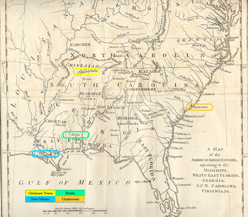
The James Adair Map circa 1768 shown below provides the reader with a geographic reference to the locales important to the Chickasaw Nation in the mid eighteenth century. Note the location of the Chickasaw Towns, Charlestown (present day Charleston, South Carolina), the principal trading hub for English trade with the Chickasaw through the mid 1760s, New Orleans, the colonial capital of French colony of Louisiana after 1718, and Mobile the pre 1718 capital of French Louisiana and the site of most Indian conferences throughout the history of French Louisiana.
The author highly recommends that the serious reader print Table 1 for ease of reference. While this site has been formatted for varied devices, not all of the content contained herein can be formatted for reading ease on smaller mobile screens. It is recommended for a premium viewer experience using a larger screened device.